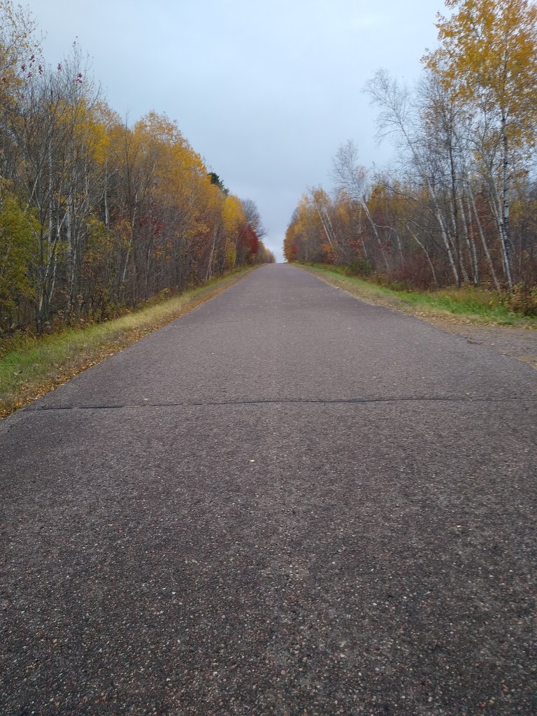
My hike on Wednesday, October 14th, began when I rolled out of bed at 5:30. On tap was a 13 mile road hike from just north of Cornell, WI, through Cornell itself, and south and east on County roads to my home base at the ShadyNook Resort.
I received two unpleasant bits of news when I woke. The first concerned my left foot. Often, the outer part of my left foot is sore after a hike. I’ve always thought it was a bone bruise. It certainly bothered me after yesterday’s hike. Usually I massage it before hitting the hay, pop some tylenol, and it is better the next morning. Not so this time. It was so sore that it was hard for it to bear weight. I hoped it would loosen as part of warming up. The other news greeted me when I stepped outside to take some things to the car – rain. I didn’t see rain in the forecast before I drove up, so it caught me by surprise. Happily, it was only a sprinkle, a nuisance, and I hoped it would remain so for the duration of the hike.
Jim was waiting for me in his truck at 7:15. After a short drive, we arrived at the jumping off point about a mile north of Cornell. I began my hike at 7:45 under grey skies. The temperature was in the 40s, and it was lightly sprinkling. Once I reached WI – 64, I turned left, crossed the bridge over the Chippewa river, and entered the town.
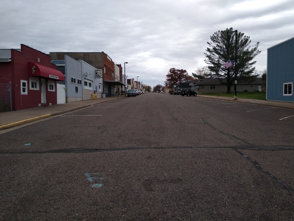
I’ve been curious about this place. A colleague of mine in the English Department at Brookfield East, Barb McCann, was from there, and she would often talk about it in the faculty lounge. With a population of 1,467, it is a designated Ice Age “trail community.” I’m told it has an ice cream store which is popular with hikers, but I hit the town too early to take advantage of it. For a little town, it has a rich history. According to Wikipedia, it was originally called Brunet Falls. Eventually, the name was changed in honor of “Ezra Cornell, one of the founders of Western Union, who owned a very large amount of timber land in the area. Upon his death in 1874, the land became part of the endowment of the Ivy League university that bears his name.”
Who knew?
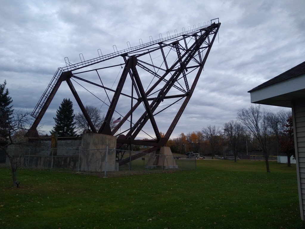
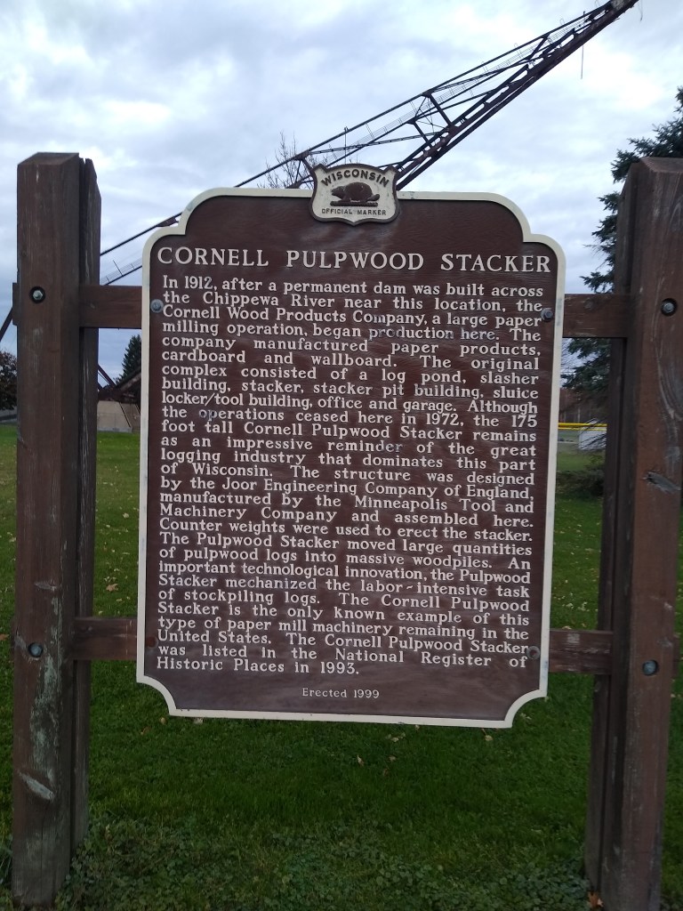
And, Cornell has a pulpwood stacker, which may be one of the most unique landmarks around. It is pictured at the top of this page. Rather than try to explain it, here is information from the State Historical Society.
Just east of here, I turned north and then east onto Main Street, a strip of old businesses which are crying out for renewal by some people with money and vision.
Shortly, I turned south and east. The terrain became more agricultural, and within an hour, I reached County Highway EE. I turned south and stayed on EE nearly 5.75 miles. The country was pretty similar to what I experienced the day before – vast tracts of farmland with stands of forest and occasional streams and ponds interspersed at intervals. The stiff breezes remained from the day before, but the wind seemed to be coming more from the south. The intermittent showers continued. They remained mostly a nuisance, although there were times that I wondered if they were going to move into another intensity category entirely. I did not stop to snap many pictures because the pain in my left foot did not ease up as I continued. Instead, the foot became even more tender. I was sure I was changing my gait, even though I tried to be as form conscious as possible(Later, I learned the problem was a couple of inflamed tendons. Good to know.).
Finally, I turned east on 155th Avenue. Less than two miles to go. One last encounter with the pesky showers. More pretty country. Soon I made the turn to enter ShadyNook. Within a half hour, I would be in my car and on my way home.