It is not often that I look upon a 20 degree temperature decrease as good news, but that was precisely my reaction when I woke to temps in the low 20s on Friday, March 12th.
I was up early on Friday to prepare for my third and last day of hiking, this time in Rusk, Barron and Washburn counties. On tap was six miles of the Hemlock Creek Segment, plus the first mile of the Tuscobia Segment. As is my habit, I opened my Weather Channel app to check the local weather. Surprise! The temperature in Rice Lake was a crisp 21 degrees, with wind chills in the teens.
This wasn’t in the forecast earlier that week, and I hadn’t planned on dressing for these conditions. How should I meet this challenge? First, I needed to reject the temptation to over dress. Even in those conditions, it is better to dress a little cool at the start and to depend on building body heat as the hike progresses. So, my heavy coat would still need to wait in my car’s trunk until my hike was finished. But I still needed to dress in layers, and the conditions told me I needed an additional one. Thankfully, I had brought some long sleeve shirts with me to wear to supper after my hikes. Thanks to a suggestion from my wife, Jane, I repurposed a shirt for that extra layer. It may not have seemed like much,but it was just what I needed.
Today’s hike would end in a new county, so I was working with a different trail angel, Craig. We had developed a relationship through previous emails and phone calls, and I found him to be curious about my journey, welcoming and supportive. A little older than I am, Craig is interested in hiking the entire trail himself, but he is a little reluctant because of his age. I suggested that he discuss it with his doctor. Our drive to my starting point at the Murphy Flowage and Recreation Area lot passed quickly. After saying good bye, I prepared to start my trek.
That brought up my second challenge – footwear. Although I had brought my snow shoes, I opted for mini-spikes to open the hike. I guessed, correctly, that all that slushy snow and ponding would be frozen solid. My mini-spikes bit right into that ice. As a result, I could negotiate the hills much more confidently, whether ascending or descending. It was truly liberating after all the slipping and sliding I had been doing.
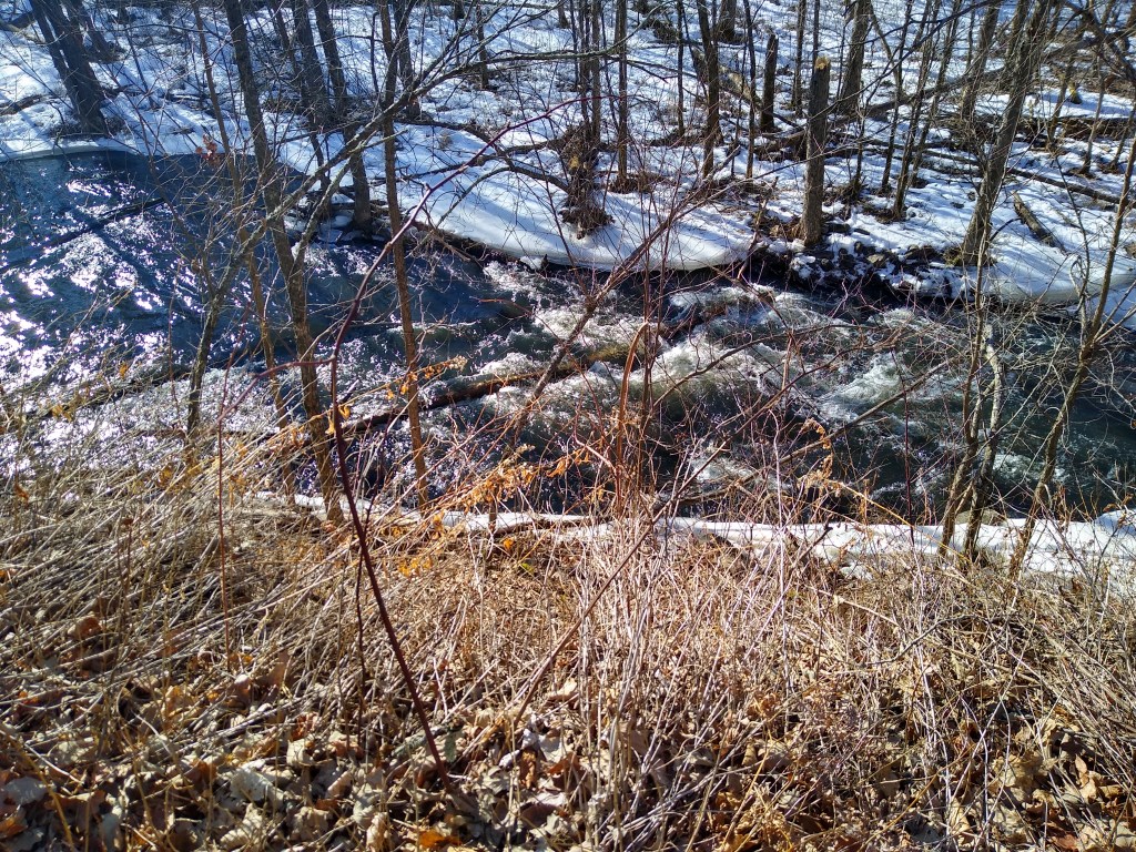
My newfound confidence was welcome, because the Hemlock Creek Segment is a feast for the eyes, particularly the first couple of miles as one walks from south to north. In this area, the trail stays quite close to the creek’s path. Within the first 50 yards of my hike, I was treated to my first view of Hemlock Creek.
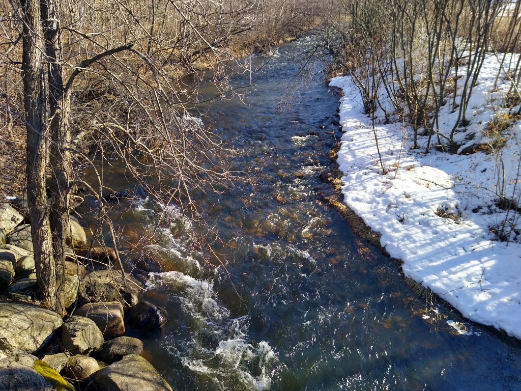
“Creek” is a bit of a misnomer. With the recent weather, the creek was running high and fast. Torrent would probably be a more apt description.
After this introduction to the creek, the trail ascended a bit before bending to the right and descending into some marsh land. The creek was to my left, glistening in brilliant sunshine. In the distance, I could see two white swans swimming. The trail began to rise again as I climbed a bluff on the creek’s north side. A beaver dam slowed it down a bit, but it still was running very fast. I kept climbing the bluff, which featured many switchbacks. Thank goodness for those mini-spikes! Finally, I reached the top, sat on a bench, and enjoyed the view you are seeing at the top of this post.
The trail continued to lead north, away from the creek. In a short time, I arrived at the junction with Bolger Road.
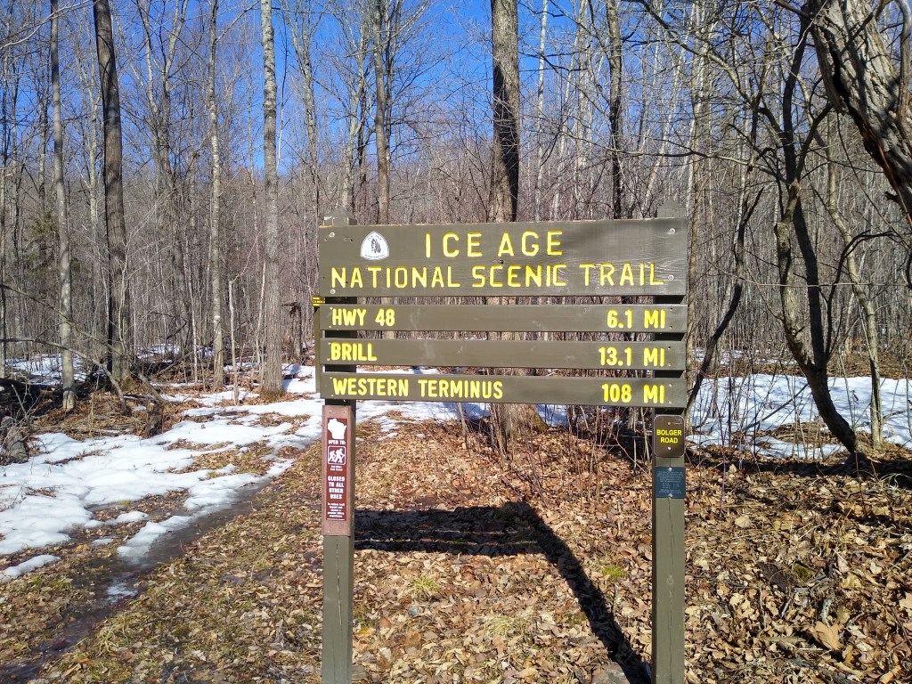
It was here that I realized I had miscalculated this morning when figuring how long this hike would be. Somehow, I had not included the 2.2 mile connecting route when totaling today’s mileage. I had assumed I was hiking 7 miles when I was really going to hike 9.2 miles. How I came to this error is a mystery to me and a bit of an irritant; a week before I had correctly recorded the projected mileage. Oh well, the distance was 9.2 miles, and I wasn’t slogging through the slush. Let’s get ‘er done!
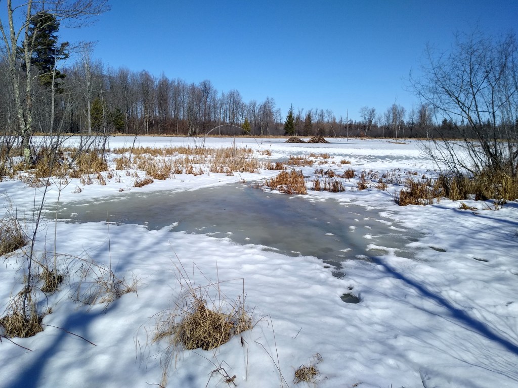
North of Bolger Road, the trail wound its way north 3.7 miles through a combination of forested areas and low lying meadows. Along the way, I spotted several beaver lodges. My guidebook also mentioned rookeries in this area. It was quiet that day, but I could readily see that this area would be a great place for bird watching.
One more stream remained to cross, Pigeon Creek. Shortly after that, the trail led me between two houses in a subdivision. I was on Finihorn Road, the end of this segment. Time to take off my back pack and enjoy a quick lunch.
Then it was time to knock off that connecting route I wanted to forget. As with most connecting routes, this was a two lane county road. It ran north and roughly parallel to Red Cedar Lake, which was to the west. I got the impression that it would be well traveled during the tourist season. I made short work of it and turned left onto Featherstone Road, the start of the 11.2 mile Tuscobia Segment. I would hike a mile of it to where my car was parked.
The 1 mile portion I walked is part of the 74-mile Tuscobia State Trail, which – according to my Guidebook – “In 1966 became the second abandoned rail line in the state to be converted for recreational use.” It is open for walking, bicycling, horseback riding and snowmobiling in the winter. I am grateful to those visionaries who could see the value in making this area available to people with a wide variety of interests and abilities. Nature should be open to the many, not the few.
