“This area is super wet. Just a heads up.”
“Most of the trail was very wet. Some areas were completely flooded out.”
“I pulled up my pants and I waded through it. Some points it was knee deep.”
When I dropped him off on Thursday, I asked Ronald to shoot me a message with trail conditions on the Grassy Lake Segment, since I would be hiking it on the 23rd. His warning prompted me to reconsider my plan. I’m OK with getting wet feet, but knee deep water? I wasn’t so sure. My wife was sure; it was a bad idea. I decided to contact trail angel Sue Greenway to ask her advice.
If, like me, you are unfamiliar with the territory where you will be hiking, I strongly recommend working with the local chapter volunteers. Sue had a Plan B ready to sell me – the 10.9 mile Timberland Hills Segment. She knew the segment very well, and she listed its qualities – mostly deep forest with the trail running past many lakes, lots of hills, and toilet facilities available at two spots along the trail. I was sold. Sue recommended a coffee shop in Cumberland where we could meet. From there, we would convoy to the trail’s end, where I could park my car. Then she would shuttle me to the trail head.
Sounded like a good Plan B to me.
I met Sue at the coffee shop Friday morning. We had previously agreed on me hiking roughly half the trail. Between then and Friday, I had changed my mind; I wanted to do the entire segment. Would that be OK? It was fine with Sue, and we drove first to the trail’s end on 30th Avenue, where I parked my car in a small lot. Then I jumped into Sue’s car, and we drove to the trail head on Leech Lake Road. I said goodbye and thanks, put on my pack and started at 8:30. The temps were in the mid 40s with cloudy skies and intermittent sprinkles.
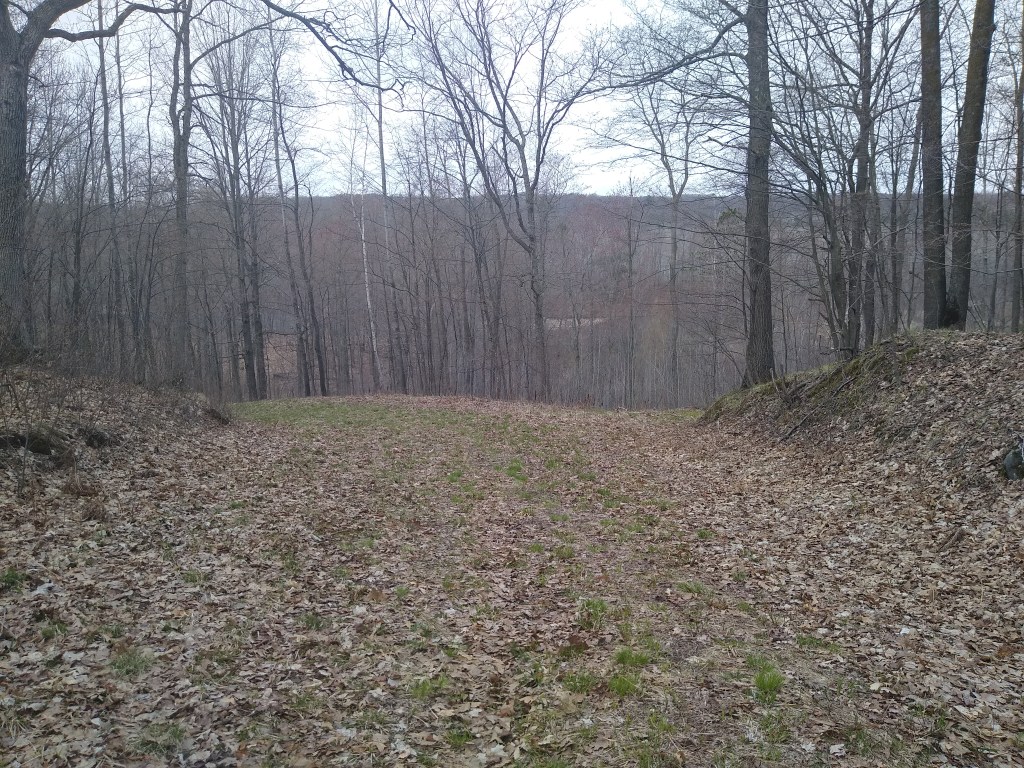
The trail immediately plunged into deep forest. Within a couple of miles, the pathway widened and got progressively more hilly. The section in the picture just above offered a majestic view of a series of lakes and beaver ponds before plunging downhill, turning left and running alongside the lakes and ponds.
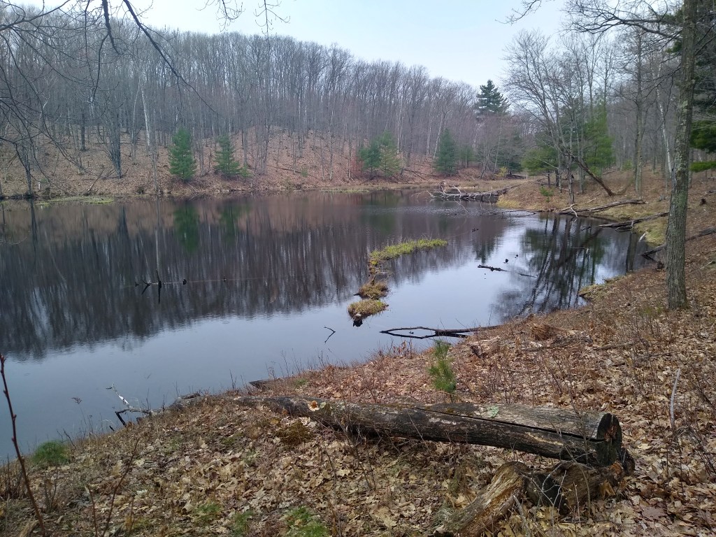
After that, the trail led into the Burnett County Forest. This is the home of the Timberland Hills Ski Area. That meant that the trail stayed fairly wide – for the “skate style” skiers – and very hilly. I had terrific views of many unnamed kettle lakes. The trails were fairly dry throughout the hike; any soft or wet spots were easy to avoid. I managed to keep my feet dry for the entire hike.
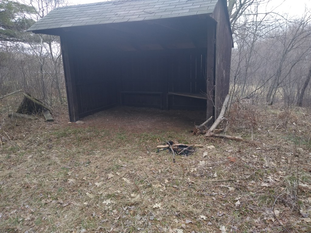
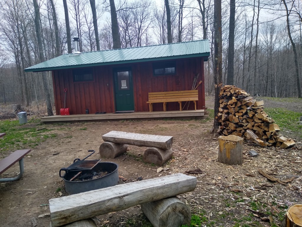
Along the way, I passed two campsites shown above. The one on the left was fairly rustic. You can see that it looks like a shed with one of the large sides open to the elements. I’m not absolutely sure of this, but I think it was erected by the Ice Age Trail Alliance. It is hard to tell because no camping facilities are shown on the map for this segment, although primitive camping is allowed on county forest lands. The campsite on the right is more elaborate. The privy is behind it, A sign said it was available for rent through Burnett County.
Normally, I don’t see anyone when I’m hiking, but on this day I met a nice couple from Minnesota and their dog at a parking area along the trail. After a short chat they continued their walk, while I took the opportunity to take a lunch break.
Shortly after I resumed, I encountered an area of clear cutting. Generally, the signage on this hike was very good. Unfortunately, some of the trees cut down in this area may have had blaze yellow trail markers on them. I walked a considerable distance without seeing a marker, longer than what I would normally expect. Thanks to the maps on my Earthmate app, I was able to find my way through that area. Once I returned to the hotel, I sent Sue a quick note alerting her to the potential problem.
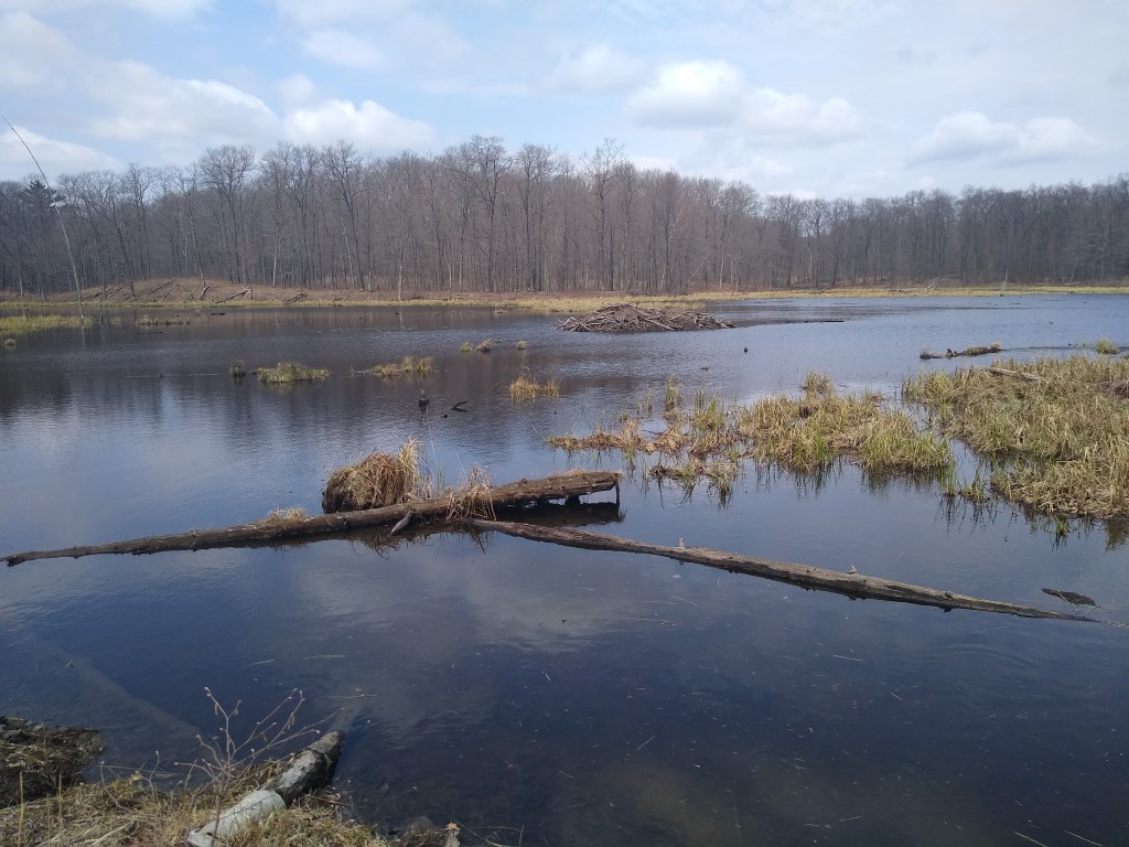
Not long after that, I exited the Burnett County Forest. I hiked about two miles in relatively open country before crossing County H and entering the Timberland West Ski Area. Although marked as forest on my map, the county seemed more open to me. The trail wound its past a number of small, very charming lakes, some containing beaver lodges. I was struck by the narrowness of the trail, particularly near the lakes. In several stretches it was a matter of staying on the track or stepping into the drink!
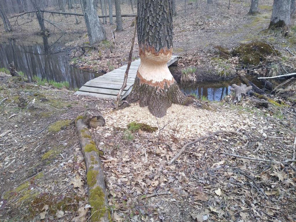
It was nearly the end of my hike when I saw what I considered to be the most interesting thing on that day’s hike, the partially gnawed tree shown at the top of this post. I have seen plenty of gnawed trees, but I was taken by the symmetry of the job done on this one. It was almost like a cartoon. I actually did a double take to confirm it was a beaver’s work.
I finished my hike at 1:30 and made my way back to Rice Lake. I had a lot to be thankful for. I was thankful I had chosen to help Ronald. I was grateful for his heads up about trail conditions. And I was extremely thankful for Sue, an excellent trail angel, for her suggestion to hike the Timberland Hills Segment, a challenging, beautiful alternative to what I had planned.
