Saturday, July 24th, was the day I completed my journey on the Ice Age Trail. There are so many aspects to this day that I don’t know where to begin. Certainly, I need to cover wrapping up the IAT, and its impact on me. But I also need to describe the challenges of this particular segment, whether I was hiking it on Day 1, Day 125, or somewhere in between. I’ll try to cover this day as completely as I can.
As usual, I spent the night before the hike preparing my equipment and my body. In this case, that meant applying moleskin to treat a couple of blisters – one on each foot. I’ve gone weeks with no foot troubles at all, only to sprout these beauties just in time for my last day on the trail. Go figure!
I also gave the Guidebook one last look to review information on the St. Croix Falls Segment. The description spent a lot of space describing the street hiking in St. Croix Falls itself, so much so that I paid scant attention to other parts of the trail in the town’s outskirts. Soon it was bed time, and I looked forward to a good night’s sleep. No such luck. First, a pizza guy knocked on our door twice trying to make deliveries (grrrr!). Then, severe thunderstorm sirens went off a second night – at 2:00.
Jane and I were up at 6:00. After breakfast, we drove from our hotel in New Richmond to the hike’s starting point on River Road in St. Croix Falls. Just after 8:20, I gave Jane a kiss goodbye, posed for a quick picture, and set off. The evening storms seemed to have cleaned out the muggy haze, and I was treated to clear skies, temps in the upper 60s, and low humidity.
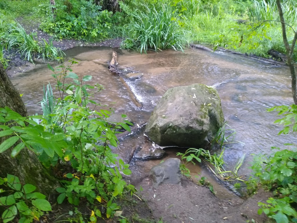
I looked upon the initial two mile stretch of rail along the St. Croix River as the “wild” portion of the hike, and I expected the sections closer to town to be somewhat urbanized, sort of like the Sturgeon Bay Segment( I was to learn later that I was mistaken.). A highlight for me was crossing Big Rock Creek. When the conditions are more dry, hikers can cross by rock hopping. Because of the storms, the creek was running high and fast, and I had to ford it. After taking unnecessary chances with my phone and key fob at Grassy Lake, this time I took the safe move of putting them in a plastic bag and stowing them in the top most pocket of my back pack. Then I removed my shoes and socks, rolled up my pants and waded across the 8-12 foot wide creek.
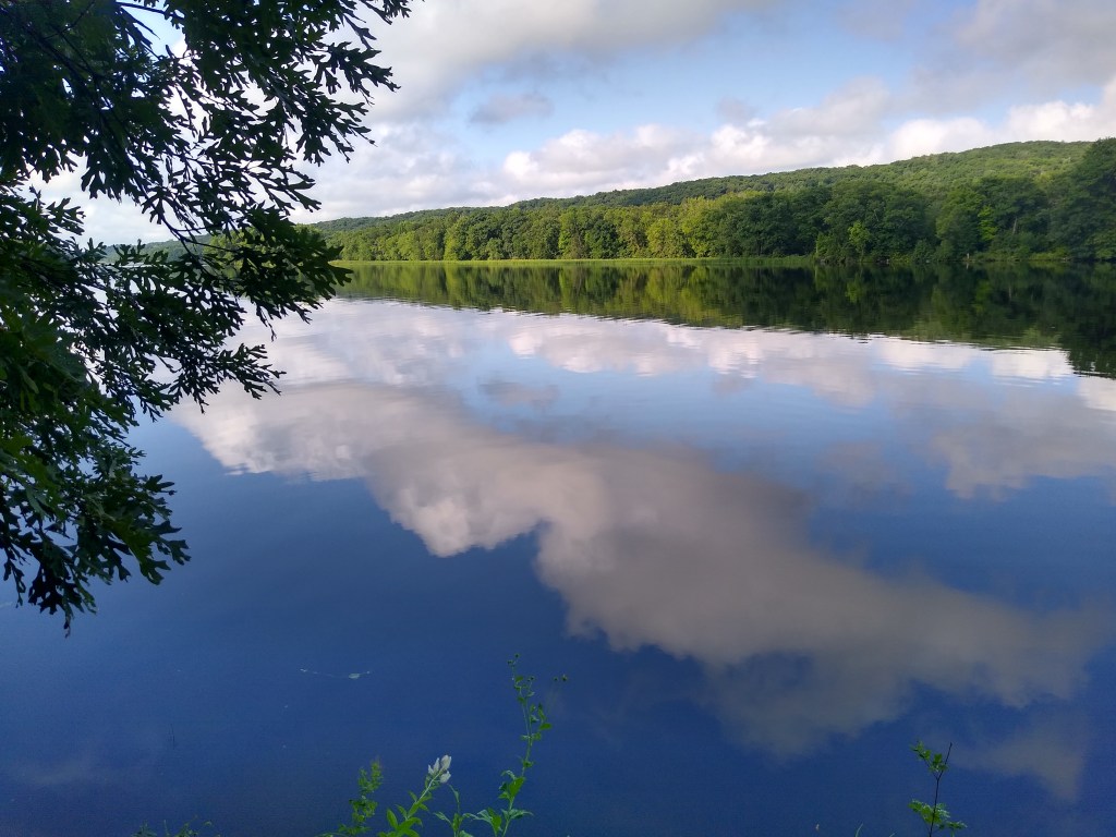
I had two more creek crossings, but these were easy to manage by rock hopping. Generally, I found this portion of the segment to be both challenging and exquisitely beautiful. The trail was muddy as a result of the night’s storms, and strewn with rocks and tree roots,, forcing me to pick my way very carefully. My rough notes stated it well – primordial. I was reminded of Plover River. The vistas along the St. Croix River were breathtaking. My habit in my journals is to place my most beautiful, memorable picture at the top of my post, which is what I did in this case.
Along the way, I passed a picturesque river front campsite, and I wondered how the occupants made it through the storm. I soon found out when I met the campers, a couple from Oconomowoc. When the sirens went off, they quickly made tracks to nearby Lions’ Park, where they waited out the storm under a picnic shelter. Must have been a long night for them.
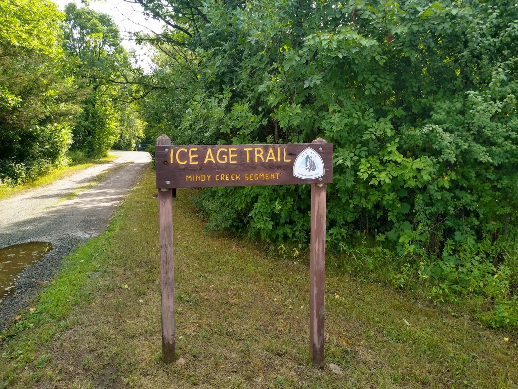
One odd thing about the St. Croix Falls Segment is that some of its sections are themselves named segments. Like Mindy Creek above, Zillmer Park and the Hospital Esker had signage describing themselves as Segments. How and why this came to be is a mystery to me. Mindy Creek was the first such “segment.” Part of the Wert Family Nature Preserve, it was named after a Native American woman from the Bad River Band of the Ojibwe who was one of the last Native Americans to live and work in the St. Croix River area. The terrain here was quite challenging, with rocky hills in the McKenzie Creek difficulty class.
Following immediately after Mindy Creek were the Zillmer and Riegel Park sections of the trail. I began to see more exposed rock outcroppings, basalt knobs, and lots of surface bedrock. The heat from the mid-day sun radiated off these rocks and really cooked me.
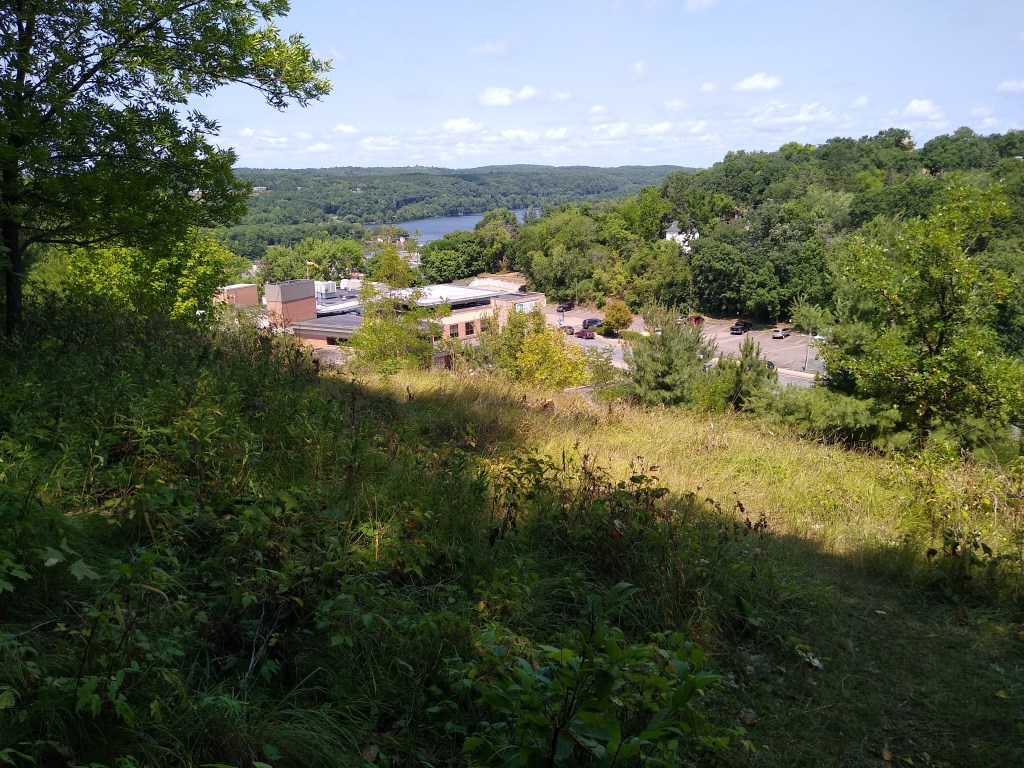
After Riegel Park, I crossed a street called Blanding Woods road. Now I knew I was entering St. Croix Falls, and I felt I was leaving the forested areas of trail behind me until I entered Interstate State Park. After taking a break with Jane and attending to a blister on my foot, I continued what I believed would be an urban hike. I was so convinced that I almost missed a very discreet sign showing the way up an extremely steep hill. The trail was more something I climbed up instead of walked on. I was ascending the last in-town “segment”, the Hospital Esker. Once I made it to the top, I was rewarded with several wonderful views of the town and the river valley. After a good half mile walk on top of the esker, I descended to Wisconsin Highway 35. Soon I reached the entrance to Interstate State Park.
In the days leading up to this hike, I wondered how the finish would be. I know some hikers more or less choreographed crossing the finish line, with notes of what they wanted or didn’t want to happen. I didn’t choreograph my crossing of the finish line in such detail, but I knew it would be very emotional for me. In conversations about it with Jane, I was aware of the emotions boiling up inside me several times. Very soon after entering the park, they started to well up again ( I learned later that the same thing happened to Jane once that she received my text that I entered the park).
Almost spontaneously, I began croaking out prayers of thanksgiving and joy. Thanks for the gift of good health. Thanks for the friends I made over the duration of this journey, and appreciation for all their help. Thanks for my wife’s love and faith in me. And thanks to the Author of all the beauty I experienced since I started this journey in 2016. All but 11 of my 125 hikes were solo, and I’ve had lots of time to think and pray while putting one foot in front of the other. The time on the trail influenced me in a lot of ways. I wasn’t planning on it affecting me spiritually.
If you have read some of my past journals, you know I’ve often said that the last mile of a hike seems to take forever. Imagine how long the last portion of this segment seemed! I began to wonder if I had taken a wrong turn onto a loop trail, and I started checking with oncoming hikers to confirm I was on the right path. By this time the trail was quite rocky, and I slowed a bit to pick my way more carefully. I was already nursing a couple of blisters. This was no time to take an ill-timed step and roll an ankle!
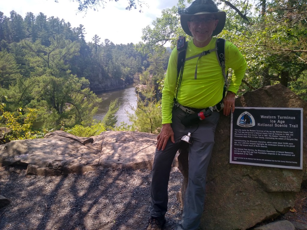
Finally, the path to the rock marking the Western Terminus came into view. Jane wasn’t there. Most likely, she was on her way from the parking lot. I knelt down, gently placed my hands on the marker, and took a deep breath.
“Completed at 1:40 pm,” I texted to Jane.
Very soon, Jane was along with an ice cold Spotted Cow.
125 days. 1127.8 miles.
Quite an adventure.